Four Russian cruise missile groups transit Sumy-Chernihiv border toward Poltava
What happened
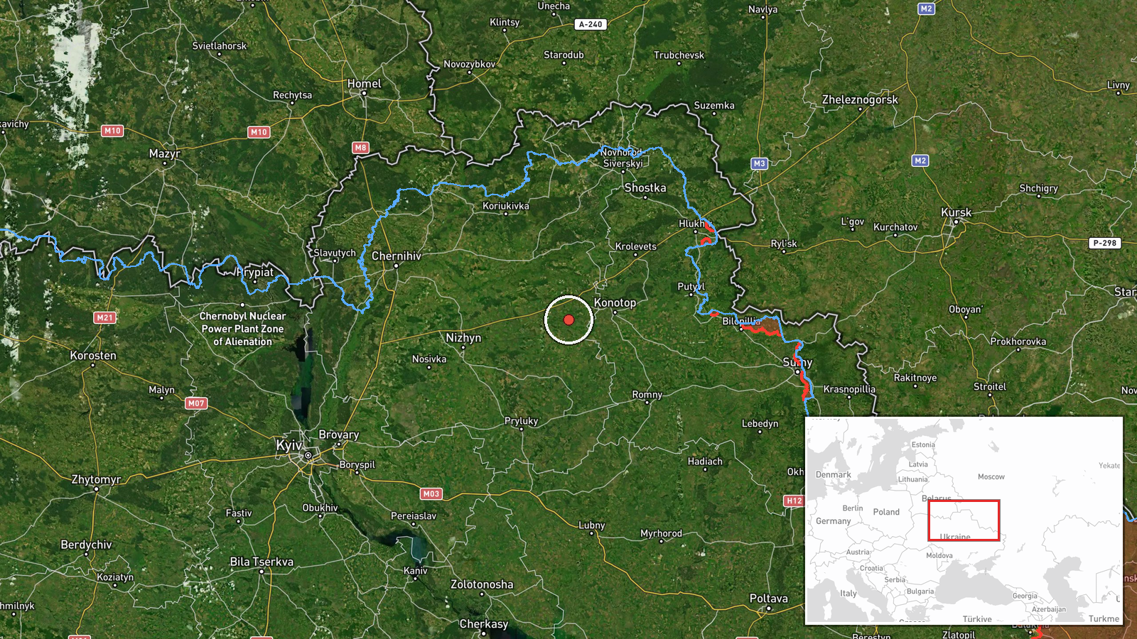
Ukrainian air-raid monitoring detected four groups of Russian cruise missiles crossing the border region between Sumy and Chernihiv oblasts on a trajectory toward Poltava Oblast during the early morning hours of September 8. The report, issued at 01:35 UTC via Telegram channel @war_monitor, characterizes the activity as part of Russia's ongoing strategic missile campaign against Ukrainian territory. No immediate impact assessment was provided in the initial detection report.
Context and assessment
The Sumy-Chernihiv border region serves as a primary transit corridor for Russian air strikes originating from Russian airspace. This latest detection reflects a sustained pattern: within hours, Ukrainian monitoring had tracked multiple drone transits through the same region and a separate cruise missile group heading toward Konotop and Pryluki in Sumy Oblast. Poltava Oblast, the apparent target area, hosts significant Ukrainian infrastructure and military logistics nodes. The scale and frequency of these detections suggest Russia is maintaining intensive pressure across multiple axes simultaneously, combining cruise missiles with jet-powered Shahed drones to saturate air defenses and complicate interception.
Sources and confidence
Single source: Telegram channel @war_monitor, which monitors official Ukrainian air-raid alert data. No cross-confirmation from other OSINT channels noted at time of report. Confidence score of 6.0 reflects the reliability of the monitoring channel but the inherent limitation of single-source reporting and lack of independent verification of the four-group composition or specific missile types.
Location
Detection point spans the international border region between Sumy and Chernihiv oblasts in northern Ukraine, approximately 51.2°N, 32.8°E, with regional-level precision. The area lies roughly 100–150 km north of Poltava Oblast, the reported target direction. This corridor between Russia's Bryansk and Kursk oblasts and central Ukraine represents established flight paths for Russian air operations.
Related events nearby
- Ukrainian air-raid monitoring: 2 groups of Russian cruise missiles detected transiting Ukrainian airspace, pas2026-09-08 01:03 UTC · Cruise Missile · En route: Shostka → Konotop/Pryluki, Sumy Oblast,
- Ukrainian air-raid monitoring reports Russian jet-powered (reaktivnyi) Shahed drones detected transiting over 2026-09-07 21:19 UTC · Drone Transit · Chernihiv Oblast, Ukraine
- Ukrainian air-raid monitoring reports Russian jet-powered (reaktivnyi) Shahed drones detected transiting from 2026-09-07 21:29 UTC · Drone Transit · En route: Kursk Oblast → Sumy Oblast, Ukraine
- Russian Shahed-136 kamikaze drones detected transiting Kyiv Oblast. One drone tracked toward Krukivshchyna, on2026-09-08 16:34 UTC · Drone Transit · Kyiv Oblast, Ukraine
- Ukrainian air-raid monitoring detected 3 groups of Russian cruise missiles transiting toward Kyiv Oblast with 2026-09-08 02:04 UTC · Cruise Missile · Kyiv Oblast, Ukraine
▶ View this event on the live map
Intel Mapper aggregates open-source reports from monitored Telegram and X channels, geolocates them, cross-checks duplicates across sources and assigns a confidence score. Entries are updated as new confirmations arrive. Read how we verify events.