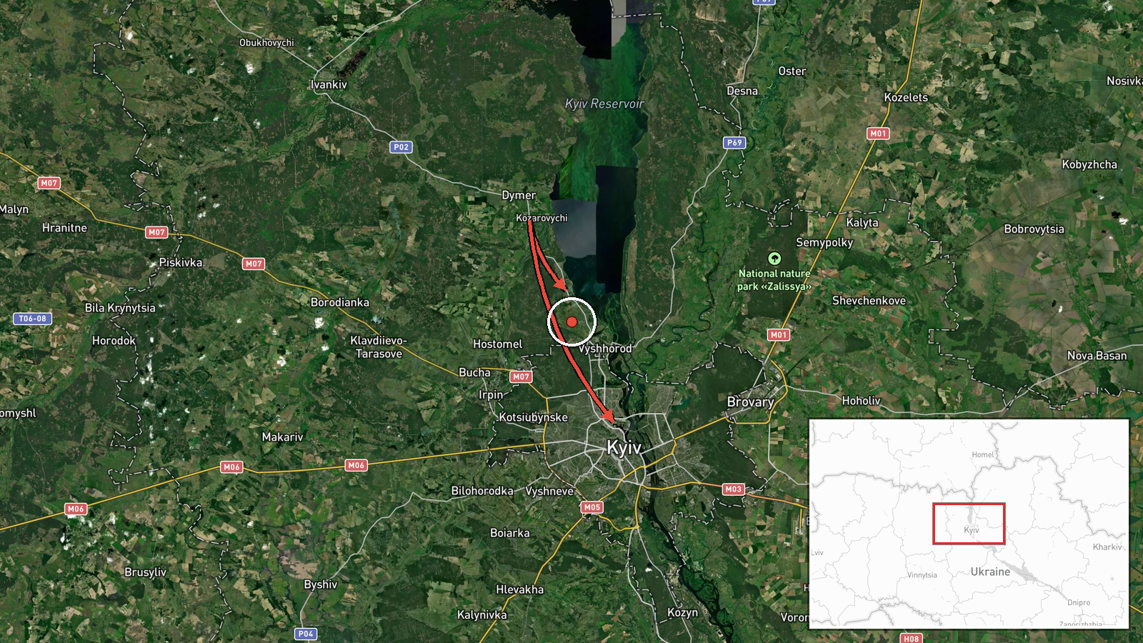
Russian jet-powered drones detected heading toward Kyiv from Dymer
What happened
Two Russian jet-powered Shahed-type drones were reportedly detected transiting from Dymer northwestward toward Vyshhorod and the Kyiv metropolitan area on September 7 at 14:49 UTC. The report was relayed via air raid alert monitoring channels. Ukrainian air defense posture and response measures were not specified in the source material.
Context and assessment
Dymer lies northwest of Kyiv and has served as a staging area for Russian drone operations targeting the capital throughout the conflict. Vyshhorod, immediately north of Kyiv proper, houses critical infrastructure including a hydroelectric facility. This detection occurred one day after high-level U.S. diplomatic engagement in Kyiv and statements by President Zelensky regarding enhanced air defense capabilities, suggesting Russia may be testing Ukrainian defenses or sustaining pressure despite diplomatic activity. The Ukrainian General Staff briefing from the same period noted singular UAVs over territory, consistent with smaller-scale drone operations rather than mass barrages.
Sources and confidence
Single source: Telegram channel @war_monitor, a monitoring service tracking air raid alerts. Confidence score of 6.0 reflects sole-source reporting without immediate cross-confirmation from official Ukrainian military channels. Would increase with corroboration from Ukrainian Air Force statements or follow-up damage assessments; would lower if no subsequent air defense engagement or impact reports emerged.
Location
Dymer is a settlement approximately 40 kilometers northwest of central Kyiv in Kyiv Oblast. The reported transit route runs southeast from Dymer toward Vyshhorod, located on the Dnieper River's right bank immediately north of Kyiv city proper. Precision is settlement-level based on named waypoints rather than specific coordinates along the flight path.
Related events nearby
- Russian strategic command alert: Kh-101 cruise missile strike expected against Ukraine starting 03:45 local ti2026-09-08 00:11 UTC · Ballistic Missile · Kyiv, Ukraine
- Former Ukrainian military intelligence chief Budanov celebrates Military Intelligence Day with personnel photo2026-09-07 18:13 UTC · Statement · Kyiv, Kyiv Oblast, Ukraine
- Ukrainian air defense alert issued for nights of 8-9 December warning of potential massive Russian strike usin2026-09-07 15:39 UTC · Siren · Kyiv, Kyiv Oblast, Ukraine
- Two Russian jet-powered (reaktivnyi) Shahed drones detected transiting over Holosiyivskyi and Kozyn areas, Kyi2026-09-07 19:40 UTC · Drone Transit · Holosiyivskyi District, Kyiv, Ukraine
- President Zelensky appeals to the United States for ballistic missile air-defense packages to strengthen Ukrai2026-09-08 14:47 UTC · Statement · Kyiv, Kyiv Oblast, Ukraine
▶ View this event on the live map
Intel Mapper aggregates open-source reports from monitored Telegram and X channels, geolocates them, cross-checks duplicates across sources and assigns a confidence score. Entries are updated as new confirmations arrive. Read how we verify events.