Iran launches second wave of anti-ship ballistic missiles at U.S. Navy in Strait of Hormuz
What happened
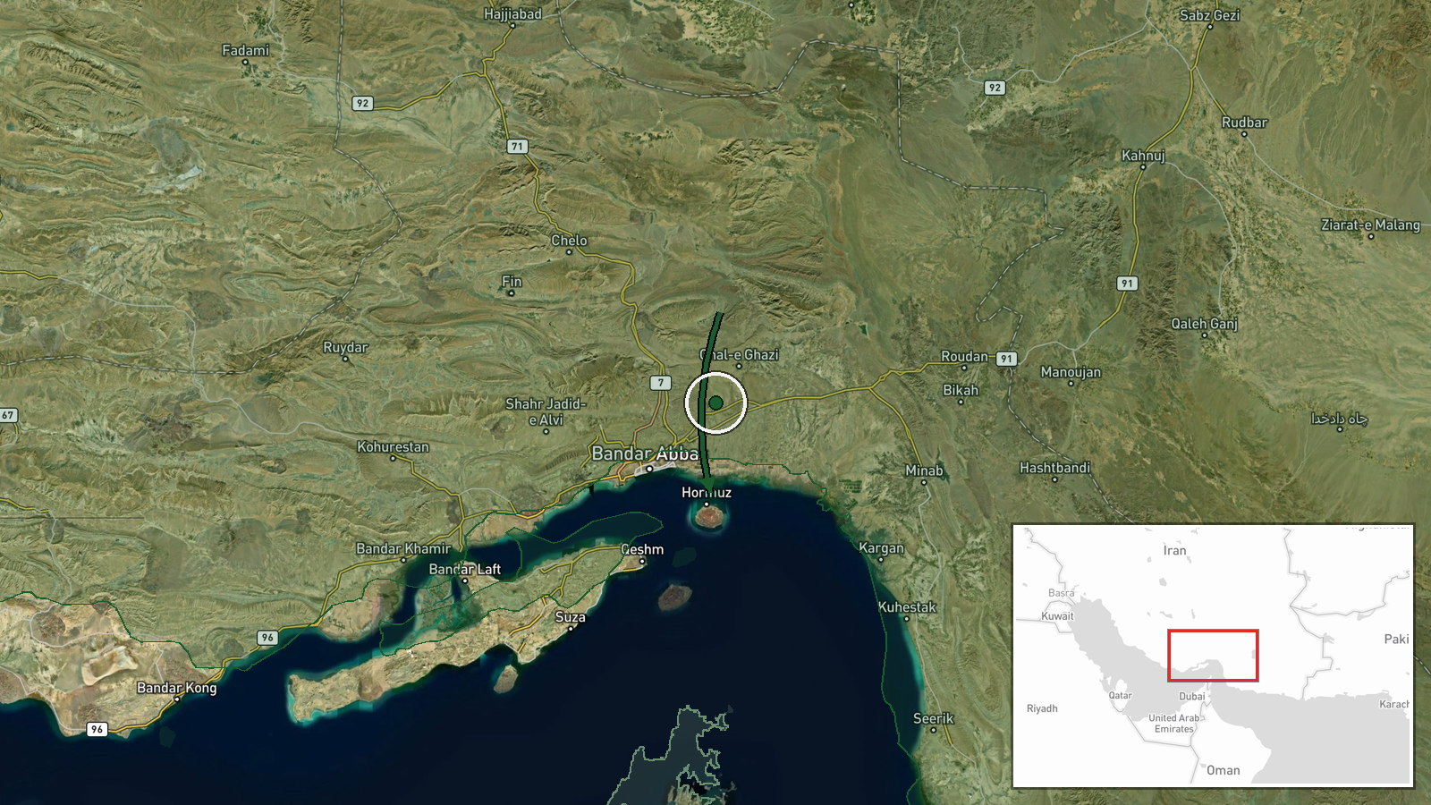
Iranian forces reportedly launched anti-ship ballistic missiles at the Strait of Hormuz on September 8, potentially targeting U.S. Navy vessels, according to local accounts. U.S. officials assess the missiles employed were more advanced variants capable of targeting moving ships. No hits were reported. The attack represents a second missile strike within three days, following earlier Iranian claims of downing a U.S. MQ-1 Predator drone and capturing an autonomous underwater vehicle in the same waters.
Context and assessment
The Strait of Hormuz remains a critical chokepoint for global oil transit and a persistent flashpoint for U.S.-Iran military tensions. The sequence of incidents on September 8—including the reported drone interception, underwater drone seizure, explicit threats to tankers at Kuwait and Bahrain ports, and now the ballistic missile launch—suggests a coordinated Iranian operational tempo aimed at establishing contested control of the waterway. U.S. assessments indicating possible Chinese or Russian technical assistance in ship-targeting capabilities would represent significant escalation, though such claims remain unconfirmed. The pattern may indicate Iranian intent to challenge U.S. naval presence or test advanced weapons systems.
Sources and confidence
Reported by @WarMonitor3 on X and @ClashReport on Telegram. Two independent channels confirm the incident, supporting the moderate-to-good confidence score of 6.0. However, confirmation relies on social media sources rather than official U.S. Navy statements. Claims of advanced targeting capability and foreign assistance derive from U.S. official assessments referenced in summary reporting. Direct verification of missile type, impact, or technical assistance would strengthen confidence significantly.
Location
The Strait of Hormuz in the Persian Gulf, determined at regional precision between Iran and Oman. The waterway is approximately 54 kilometers wide at its narrowest point. Nearby anchorages include Kuwaiti and Bahraini ports mentioned in concurrent Iranian threats, situating the engagement in the western Persian Gulf's most congested maritime zone.
Related events nearby
- Iran's IRGC Navy warns all oil tanker crews at ports and anchorages in Kuwait and Bahrain to abandon their ves2026-09-08 20:17 UTC · Statement · Strait of Hormuz, Persian Gulf
- Possible ongoing naval engagement in the Strait of Hormuz between U.S. and Iranian forces. Reports indicate ac2026-09-08 19:34 UTC · Ballistic Missile · Strait of Hormuz, Persian Gulf
- IRGC spokesperson claims capture of advanced U.S. unmanned submarine (Anduril Dive-LD) in Strait of Hormuz, bo2026-09-08 18:56 UTC · Statement · Strait of Hormuz, Persian Gulf
- Iran's IRGC Navy reportedly captured an intact Anduril Dive-LD autonomous underwater drone (~3-ton, 19 ft, $2.2026-09-08 18:10 UTC · Security · Strait of Hormuz, Persian Gulf
- Iranian air defenses successfully intercepted and destroyed a U.S. MQ-1 Predator drone over the Strait of Horm2026-09-08 17:26 UTC · Air Defense · Strait of Hormuz, Persian Gulf
▶ View this event on the live map
Intel Mapper aggregates open-source reports from monitored Telegram and X channels, geolocates them, cross-checks duplicates across sources and assigns a confidence score. Entries are updated as new confirmations arrive. Read how we verify events.