Russian Shahed-136 drones detected transiting toward Poltava Oblast towns
What happened
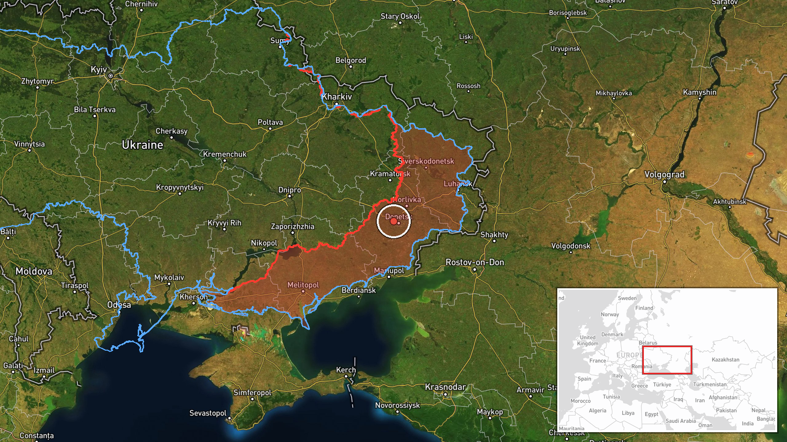
Two Russian Shahed-136 reactive kamikaze drones were detected in transit from Donetsk Oblast toward the towns of Kremenchuk and Hlobyne in Poltava Oblast on 1 October at 10:52 UTC, according to Telegram channel @war_monitor. Shahed-136 drones are jet-engine unmanned aircraft designed for one-way attack missions. The report indicates ongoing Russian drone operations against Ukrainian targets in central Ukraine, though the outcome of any subsequent strikes was not specified in the available reporting.
Context and assessment
Kremenchuk and Hlobyne lie in Poltava Oblast, a region north of the active ground fighting in Donetsk and Luhansk. Russia has conducted sustained drone campaigns against rear-area Ukrainian positions throughout the conflict, targeting both civilian infrastructure and military facilities. The detection of these drones follows other Russian aerial operations on the same date, including reported airstrikes in Donetsk Oblast. Ukrainian forces have simultaneously struck Russian ammunition and drone storage facilities, as recorded in contemporaneous reports from the same day. Such transit detections, while common in intelligence reporting, reflect the ongoing aerial dimension of the conflict and Russia's demonstrated intent to project power beyond the immediate ground-combat zone.
Sources and confidence
Reported by single Telegram channel @war_monitor with no corroborating cross-source confirmation available. Confidence score of 6.0 reflects limited source diversity; the channel provides regular conflict updates but this specific report lacks independent verification. Confirmation from additional Ukrainian air-defense or intelligence sources, or evidence of strikes in the target area, would increase confidence. Official statements from either belligerent would strengthen the assessment.
Location
Donetsk Oblast (Russian-controlled territory) as reported point of origin. Kremenchuk is a major city on the Dnieper River in central Poltava Oblast, approximately 280 km northwest of the detection point. Hlobyne is a smaller settlement also in Poltava Oblast. The low location confidence reflects imprecision in the original report's geographic markers and the regional-level precision of available coordinates.
Related events nearby
- Russian aerial bombs struck a Ukrainian ground-based robotic system moving along a road in Donetsk region. Foo2026-10-01 05:30 UTC · Airstrike · Donetsk Oblast, Ukraine
- Ukrainian forces confirmed destruction of 23 September 2026 of Rubikon unit drone storage facilities near Voln2026-10-01 10:59 UTC · UAS Strike · Volnovakha, Donetsk Oblast, Ukraine
- Russian forces advanced (~8 km²) in the Shakhove sector per DeepState frontline update. No settlement center c2026-10-01 00:20 UTC · Combat · Shakhove sector, Ukraine
- Ukrainian forces struck a Russian rocket-artillery ammunition depot near Verkhnokamianka, Luhansk Oblast. Atta2026-10-01 10:59 UTC · UAS Strike · Verkhnokamianka, Luhansk Oblast, Ukraine
- Ukrainian forces struck a Russian rocket-artillery weapons storage facility (РАО — ракетно-артилерійське озбро2026-10-01 11:00 UTC · UAS Strike · Luhansk Oblast or Donetsk Oblast, Russian-controll
▶ View this event on the live map
Intel Mapper aggregates open-source reports from monitored Telegram and X channels, geolocates them, cross-checks duplicates across sources and assigns a confidence score. Entries are updated as new confirmations arrive. Read how we verify events.