Russian Shahed drones detected transiting Kyiv and Vinnytsia oblasts overnight
What happened
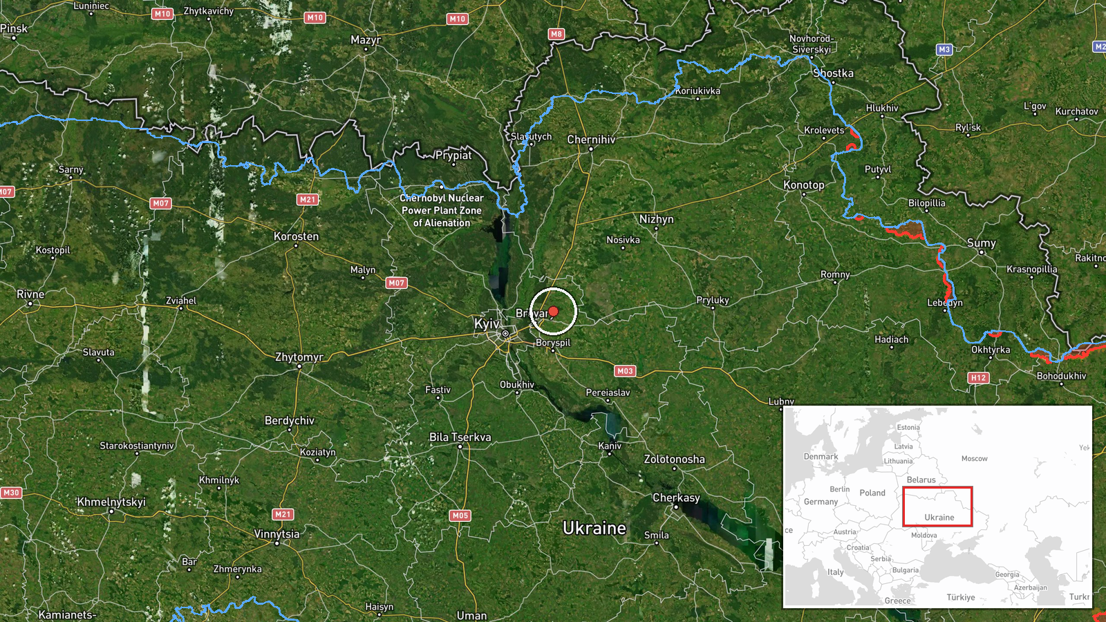
Ukrainian air raid monitoring reported detection of Russian jet-powered Shahed drones in transit over Kyiv Oblast and Vinnytsia Oblast during overnight hours of 7–8 September. The monitoring channel anticipated additional drone launches targeting Kyiv region and potentially extending into western oblasts. No immediate strike reports or casualties were specified in the initial detection alert.
Context and assessment
This detection follows a pattern of Russian drone operations observed throughout 7 September, including concurrent transit reports over Chernihiv Oblast and movements toward central Kyiv. The incident occurs amid diplomatic activity—U.S. representatives met with President Zelensky on 6 September—and an air defense alert issued for potential large-scale combined ballistic and cruise missile strikes. Russian drone campaigns have increasingly targeted Kyiv's energy infrastructure and civilian areas as winter approaches, making repeated surveillance and transit detections operationally significant markers of sustained pressure.
Sources and confidence
Reported by Telegram channel @war_monitor (air raid monitoring), a single source providing real-time air defense alerts. Confidence score of 6.0 reflects detection-based reporting rather than post-strike verification. Cross-confirmation would require additional independent monitoring channels or official Ukrainian air force statements. Confidence would increase with corroborating reports from other monitoring services or official disclosure of engagement.
Location
Kyiv Oblast and Vinnytsia Oblast, central Ukraine. The transit route indicated movement over populated regions west and northwest of Kyiv city. Prior concurrent detections mentioned Dymer–Vyshhorod corridor and Chernihiv Oblast approach vectors, suggesting multi-axis drone deployment pattern. Geographic precision remains regional pending detailed flight path confirmation.
Related events nearby
- Russian Shahed-136 kamikaze drones detected transiting Kyiv Oblast. One drone tracked toward Krukivshchyna, on2026-09-08 16:34 UTC · Drone Transit · Kyiv Oblast, Ukraine
- Ukrainian air-raid monitoring detected 3 groups of Russian cruise missiles transiting toward Kyiv Oblast with 2026-09-08 02:04 UTC · Cruise Missile · Kyiv Oblast, Ukraine
- Ukrainian air-raid alert monitoring system reports all-clear signal (threat repeal) for Kyiv region after ball2026-09-07 23:25 UTC · Siren · Kyiv Oblast, Ukraine
- Two Russian jet-powered (reaktivnyi) Shahed drones detected transiting over Cherkasy Oblast heading toward Kyi2026-09-07 17:15 UTC · Drone Transit · Boryspil Sector, Kyiv Oblast, Ukraine
- President Zelensky appeals to the United States for ballistic missile air-defense packages to strengthen Ukrai2026-09-08 14:47 UTC · Statement · Kyiv, Kyiv Oblast, Ukraine
▶ View this event on the live map
Intel Mapper aggregates open-source reports from monitored Telegram and X channels, geolocates them, cross-checks duplicates across sources and assigns a confidence score. Entries are updated as new confirmations arrive. Read how we verify events.