Ukraine strikes Russian command post in Lysychansk, Luhansk Oblast
What happened
Ukrainian forces conducted an unmanned aerial system (UAS) strike against a Russian command-observation post (КП) in Lysychansk, Luhansk Oblast on the night of 29–30 September 2026, according to the Ukrainian General Staff. The post served an unspecified Russian military subunit. The General Staff did not disclose the extent of damage or casualties resulting from the strike.
Context and assessment
Lysychansk, a key city in the Luhansk industrial region, has been contested territory throughout the conflict and represents strategically important high ground in the eastern Luhansk plain. The strike aligns with a pattern of Ukrainian targeting of Russian command infrastructure and logistics nodes across multiple fronts, reflected in the 189 reported engagements on 29 September alone. Concurrent strikes on a Russian drone storage depot near Horlivka on the same dates suggest coordinated Ukrainian offensive operations targeting Russian rear-area assets and operational capacity. Such strikes on command posts may indicate Ukrainian efforts to disrupt Russian command and control networks.
Sources and confidence
Single source: Ukrainian General Staff Telegram channel (@GeneralStaffZSU). No cross-confirmation from independent observers or Ukrainian regional military officials reported. Confidence score of 8.0 reflects official Ukrainian military disclosure but lack of independent verification of strike outcome or target specifics. Confirmation by Ukrainian field commanders or visual evidence would strengthen confidence; Russian counterclaim of interception would lower it.
Location
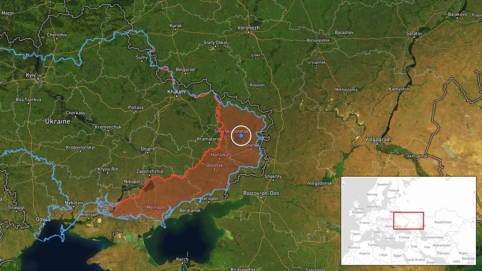
Lysychansk city center, Luhansk Oblast, eastern Ukraine. Coordinates approximate to city region (48.94°N, 38.89°E). Located on elevated terrain overlooking the Siverskyy Donets River valley, approximately 15 km northwest of Russian-held Pervomaisk. Sits within the densely populated industrial area of the Luhansk Donbas region.
Related events nearby
- Ukrainian General Staff reports 189 combat engagements across all fronts on 29 Sep 2026. Russia conducted 1 mi2026-09-29 19:06 UTC · Report · Ukraine (Multiple Fronts)
- Ukrainian Defense Forces struck an enemy drone storage depot in Hrantine, Donetsk Oblast on 29–30 September 202026-09-30 08:21 UTC · UAS Strike · Horlivka, Donetsk Oblast, Ukraine
▶ View this event on the live map
Intel Mapper aggregates open-source reports from monitored Telegram and X channels, geolocates them, cross-checks duplicates across sources and assigns a confidence score. Entries are updated as new confirmations arrive. Read how we verify events.