Israeli forces conduct raids and searches in Quneitra village amid reconnaissance flights
What happened
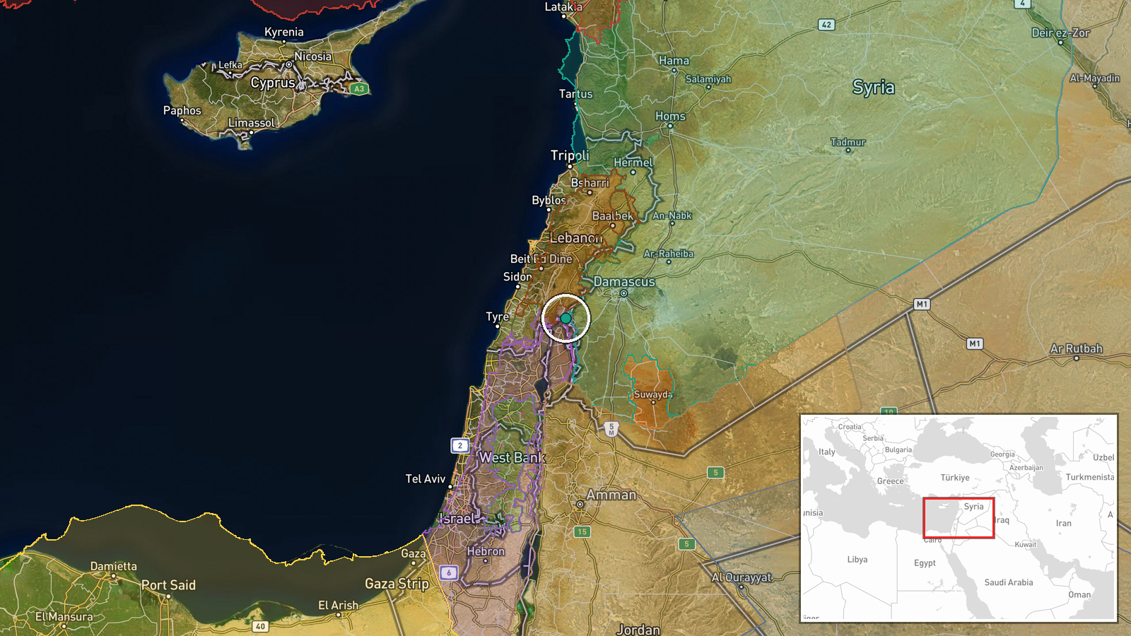
Israeli occupation forces reportedly conducted a series of raids and searches in Ain al-Abed village in Quneitra Countryside, southern Syria, on 8 September 2026. The operation occurred amid reconnaissance aircraft activity overhead in the area. The report was carried by the Telegram channel AJSyriaNow, an Arabic-language source covering Syrian affairs. No immediate details on the scale, duration, or specific targets of the searches were provided in the available reporting.
Context and assessment
This operation in Quneitra occurs on a day when UN investigators issued multiple statements documenting Israeli military violations of Syrian sovereignty in southern Syria, including detention and transfer of Syrian civilians across the border. Ain al-Abed sits in contested territory near the Golan Heights, an area where Israeli military presence has increased significantly following recent regional escalations. The pattern of raids, reconnaissance flights, and ground operations in Quneitra and Daraa over recent weeks suggests sustained Israeli security operations targeting suspected militant elements or gathering intelligence. Such operations typically precede or accompany detention sweeps, as documented in concurrent UN reporting.
Sources and confidence
Single source via Telegram (@AJSyriaNow), an Arabic news channel covering Syria. No cross-confirmation from other channels or official statements at time of reporting. Confidence of 7.5 reflects single-source reporting, though timing aligns with other documented operations in the same area on the same date. Confirmation from Israeli military, Syrian authorities, or independent observers would increase confidence.
Location
Ain al-Abed village in Quneitra Countryside, southern Syria, located at approximately 33.33°N, 35.80°E. The settlement lies in the contested zone near the Israeli-occupied Golan Heights, close to the Syria-Israel border. The area sits roughly 40 kilometres south of Damascus and within the demilitarized zone established by the 1974 disengagement agreement.
Related events nearby
- UN Commission of Inquiry reports Israel arrested and transferred 49 Syrian detainees, including 2 children, po2026-09-08 16:03 UTC · Statement · Golan Heights / Quneitra, Southern Syria
- UN Commission of Inquiry warned that Israel's military operations in southern Syria—including raids, incursion2026-09-08 14:03 UTC · Statement · Southern Syria, Golan Heights Region
- UN Commission of Inquiry expresses deep concern over Israeli military violations in southern Syria, including 2026-09-08 08:46 UTC · Statement · Quneitra and Daraa, Southern Syria
- UN Commission of Inquiry on Syria expressed deep concern over Israeli violations of Syrian sovereignty in sout2026-09-08 09:58 UTC · Statement · Southern Syria (Quneitra and Daraa)
- UN Commission of Inquiry on Syria reports Israel arrested 49 children on Syrian territory and transferred them2026-09-08 12:46 UTC · Security · Golan Heights / Quneitra, Syria
▶ View this event on the live map
Intel Mapper aggregates open-source reports from monitored Telegram and X channels, geolocates them, cross-checks duplicates across sources and assigns a confidence score. Entries are updated as new confirmations arrive. Read how we verify events.