Israeli forces establish temporary checkpoint on Syria-Israel border road in Quneitra
What happened
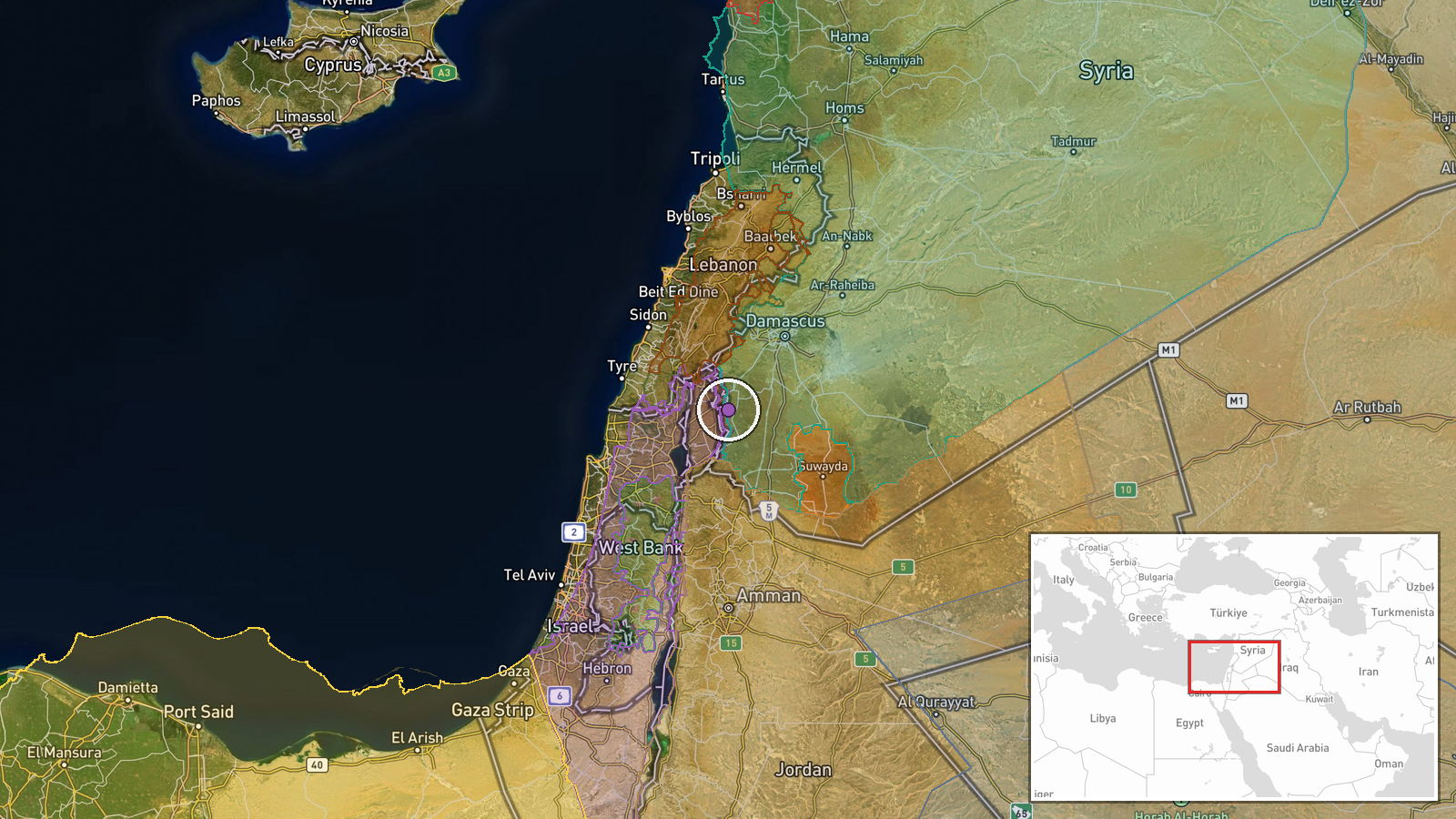
Israeli occupation forces set up a temporary checkpoint on the Ofaniya–Khan Arnabah road in northern Quneitra Governorate, Syria, according to a report from Syria Now on Telegram. The checkpoint was established on September 7 at approximately 16:49 UTC. The road connects two settlements in the demilitarized zone near the Syria-Israel border.
Context and assessment
The checkpoint deployment occurs amid a pattern of heightened Israeli military activity in Quneitra Governorate on September 7. Earlier that day, Israeli forces conducted a drone strike targeting suspects near the border fence in the Rafid area, and artillery fire struck the wider Quneitra Countryside. These operations may reflect Israeli efforts to reinforce control over crossing points and movement routes in the demilitarized zone following the ceasefire that has governed this sector since 1974. Temporary checkpoints can serve intelligence-gathering or interdiction functions, though their precise purpose remains unclear from available reporting.
Sources and confidence
Single source: Telegram channel @AJSyriaNow (Syria Now). No cross-confirmation from other channels or regional monitors reported. Confidence score of 7.5 reflects single-source reporting and lack of independent verification. Confirmation from additional regional sources, satellite imagery, or Israeli military statements would increase confidence. Contradictory reporting or removal of the report would lower it.
Location
Ofaniya is a settlement in northern Quneitra Governorate near the 1974 UN-demarcated ceasefire line (UNDOF zone) separating Syrian and Israeli-controlled territory. Khan Arnabah is located several kilometers to the north along the same road. The road itself runs through the demilitarized zone separating the two nations. Precision is settlement-level based on named locations.
Related events nearby
- UN Commission of Inquiry on Syria reports Israel arrested 49 children on Syrian territory and transferred them2026-09-08 12:46 UTC · Security · Golan Heights / Quneitra, Syria
- UN Commission of Inquiry reports Israel arrested and transferred 49 Syrian detainees, including 2 children, po2026-09-08 16:03 UTC · Statement · Golan Heights / Quneitra, Southern Syria
- UN Commission of Inquiry warned that Israel's military operations in southern Syria—including raids, incursion2026-09-08 14:03 UTC · Statement · Southern Syria, Golan Heights Region
- UN Commission of Inquiry expresses deep concern over Israeli military violations in southern Syria, including 2026-09-08 08:46 UTC · Statement · Quneitra and Daraa, Southern Syria
- Israeli occupation forces fired three artillery rounds at agricultural lands between Sayda Al-Hanoot and Razan2026-09-07 18:52 UTC · Artillery · Between Sayda Al-Hanoot and Razaniyya villages, Qu
▶ View this event on the live map
Intel Mapper aggregates open-source reports from monitored Telegram and X channels, geolocates them, cross-checks duplicates across sources and assigns a confidence score. Entries are updated as new confirmations arrive. Read how we verify events.