Russian Geran-2 drone strikes civilian vehicles on road in Pavlohrad
What happened
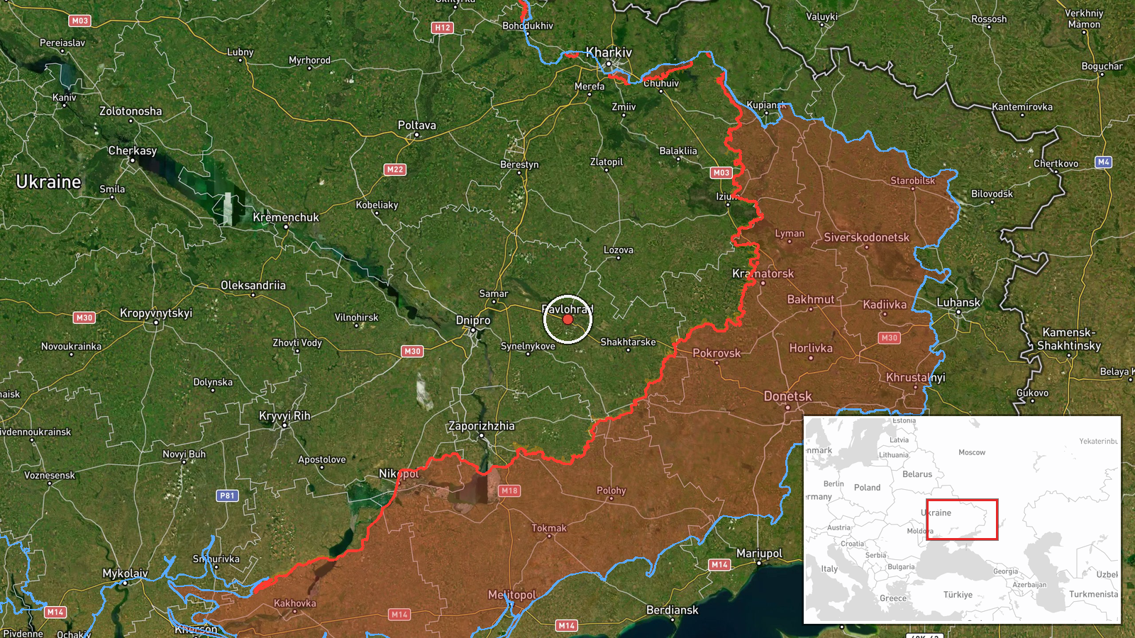
A Russian Geran-2 (Shahed-136) unmanned aerial system struck a road section in Pavlohrad, Dnipropetrovsk Oblast, reportedly hitting civilian vehicles and causing casualties. The strike occurred on 14 September 2026 at approximately 15:45 UTC. The report describes impact on civilian infrastructure rather than military targets, indicating either targeting of dual-use routes or impacts to non-military traffic during an attack.
Context and assessment
Pavlohrad, located in southeastern Ukraine's Dnipropetrovsk Oblast, sits roughly 65 kilometers southwest of Donetsk and remains under Ukrainian control. The city has historically been a target for long-range Russian strikes, including drone and missile attacks on infrastructure and populated areas. Geran-2 strikes on road networks and civilian areas may reflect Russian attempts to disrupt logistics, civilian movement, and morale in rear areas. Such strikes on populated routes follow a pattern of Russian drone operations against both military and civilian targets across Ukrainian territory.
Sources and confidence
Reported by X account @ConflictTR. Single source with no cross-confirmation noted in available data. Confidence score of 6.0 reflects unconfirmed report status. Would be raised by: verification from Ukrainian official sources, additional independent channel confirmation, or geolocated imagery. Would be lowered by: contradictory reports or evidence of misidentification.
Location
Pavlohrad is a city of approximately 330,000 in Dnipropetrovsk Oblast in southeastern Ukraine. Located at 48.53°N, 35.87°E, it sits in the Samara River valley and serves as a regional industrial and transportation hub. The city remains approximately 70 kilometers west of active ground combat zones as of mid-2026.
Related events nearby
- Ukrainian General Staff operational update (22:00, Sept 14): 225 combat clashes across all fronts. Russia cond2026-09-14 19:09 UTC · Statement · Eastern Ukraine Frontline (Donetsk, Luhansk, Khark
▶ View this event on the live map
Intel Mapper aggregates open-source reports from monitored Telegram and X channels, geolocates them, cross-checks duplicates across sources and assigns a confidence score. Entries are updated as new confirmations arrive. Read how we verify events.